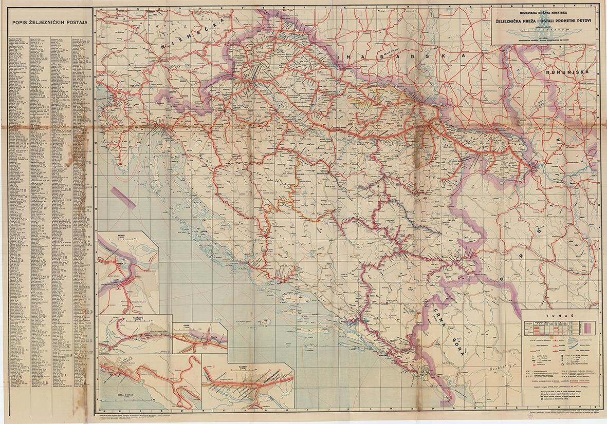
Descripción
Lithograph in colour, printed on three sheets and originally joined together, 130 x 92 cm (51,18 x 36,2 inches) (soft folds slightly stained and with tiny holes, otherwise in a good condition). A very large map, shows the railroad and traffic routes in the Independent State of Croatia, during WW II, and was published by the Ministry for Traffic. Marked are different types of railroads and roads, railroad under construction, tunnels, different types of stops, post stops, telegraphs, tolls etc. Colours around railroad lines mark different offices in charge of them. Yellow coloured lines are controlled by the Zagreb office, purple by the Sarajevo office and blue ones by the Ministry for Forestry and Mining. It embraces the area between Slovenia, Montenegro, Belgrade and north Croatia, with the Hungarian border. The in-set maps show Zemun, Zagreb, Sarajevo, Rijeka and Osijek. The map was printed in 1944, in the last year of the war, and after the capitulation of Italy, which left the northwest border at Istria opened. This large map, which was confirmed by the War Ministry, as mentioned in the lower margin, was probably meant for high government officials. We could not trace any other examples of this map on the market or in institutions worldwide. After WWII these maps would be destroyed for political reasons. N° de ref. del artículo 65102
Contactar al vendedor
Denunciar este artículo