
Importe total (1 artĒculo artĒculos):
Destino del pedido:

estrecho de magallanes fragata santa maria de jose de vargas ponce, Antiguo o usado (11 resultados)
Comentarios
Ir a los resultados principales
Filtros de b·squeda
Tipo de artĒculo
- Todos los tipos de productos
- Libros (11)
- Revistas y publicaciones (No hay ning·n otro resultado que coincida con este filtro.)
- C¾mics (No hay ning·n otro resultado que coincida con este filtro.)
- Partituras (No hay ning·n otro resultado que coincida con este filtro.)
- Arte, grabados y p¾sters (No hay ning·n otro resultado que coincida con este filtro.)
- FotografĒas (No hay ning·n otro resultado que coincida con este filtro.)
- Mapas (No hay ning·n otro resultado que coincida con este filtro.)
- Manuscritos y coleccionismo de papel (No hay ning·n otro resultado que coincida con este filtro.)
Condici¾n
- Todos los libros
- Nuevos (No hay ning·n otro resultado que coincida con este filtro.)
- Antiguos o usados (11)
Encuadernaci¾n
- Todas
- Tapa dura (6)
- Tapa blanda (No hay ning·n otro resultado que coincida con este filtro.)
Mßs atributos
- Primera edici¾n (7)
- Firmado (No hay ning·n otro resultado que coincida con este filtro.)
- Sobrecubierta (No hay ning·n otro resultado que coincida con este filtro.)
- Con imßgenes (10)
- No impresi¾n bajo demanda (11)
Idioma (1)
Precio
- Cualquier precio
- Menos de EUR 20 (No hay ning·n otro resultado que coincida con este filtro.)
- EUR 20 a EUR 45 (No hay ning·n otro resultado que coincida con este filtro.)
- Mßs de EUR 45
Gastos de envĒo gratis
Ubicaci¾n del vendedor
Valoraci¾n de los vendedores
-
Relaci¾n del ultimo viage al Estrecho de Magallanes de la fragata de S. M. Santa Maria de la Cabeza en los anos de 1785 y 1786. Extracto de todos los anteriores desde su descubrimiento impresos y mss. y noticia de los habitantes. 1788
Publicado por Viuda de Ibarra, Hijos y Compa±Ēa, Madrid, 1788
Librería: Donald A. Heald Rare Books (ABAA), New York, NY, Estados Unidos de America
Miembro de asociaci¾n: ABAA ILAB
Calificaci¾n del vendedor: 4 de 5 estrellas

Original o primera edici¾n
EUR 3.166,36
Convertir monedaGratis gastos de envĒo en Estados Unidos de AmericaCantidad disponible: 1 disponibles
A±adir al carrito2 volumes. 4to. (9 3/8 x 7 inches). Engraved portrait frontispiece, 4 folding engraved maps and 4 folding tables [with:] Apķndice a la Relacion del Viage al Magallanes. Madrid: Viuda de Joaquin Ibarra, 1793. First Edition. Folding table and folding map. Contemporary quarter sheep and marbled boards. Volume I spine with paper label. Appendix spine with red morocco lettering piece, lettered gilt First edition, one of the classic works of navigation to the Magellan Strait. The Relacion is one of the best descriptions of the Strait of Magellan and Patagonia in the 18th century. It is based on the scientific explorations undertaken by Captain Antonio de Cordoba on board the frigate Santa Maria de la Cabeza, with the aim of exploring Patagonia and to determine the continuity of the use of the Strait for Spanish ships in voyages to the Pacific, although without success as "after these expeditions the Spanish trade routes were exclusively to east ports and then overland to the Pacific ports" (Hill). Vargas y Ponce, to whom authorship is normally attributed, used also the journals of Lieutenants Galiano and Belmonte, who sailed with Cordoba. In 1793, the Appendix present here was published "Obra interesante y bien publicada" (Palau); this later part is a historical view of former expeditions, including those of Drake and Bougainville. The illustration of this work comprises between the Relacion and the Appendix five large folding maps (including the "Carta reducida del Estrecho de Magallanes", "Carta Esferica de la parte sur de la Amķrica Meridional", and two multi-inset maps of ports), a frontispiece portrait of Fernando de Magallanes by Selma, and five folding tables. Sabin 16765 & 1729; Hill 1756; Howgego c180; JCB II, 3224; Palau 352514 & 352515.
-
Relaci¾n del ultimo viage al Estrecho de Magallanes de la fragata de S. M. Santa Maria de la Cabeza en los anos de 1785 y 1786. Extracto de todos los anteriores desde su descubrimiento impresos y mss. y noticia de los habitantes. 1788. Madrid. Viuda de Ibarra
Publicado por Viuda de Ibarra, Hijos y Compa±Ēa, Madrid, 1788
Librería: Donald A. Heald Rare Books (ABAA), New York, NY, Estados Unidos de America
Miembro de asociaci¾n: ABAA ILAB
Calificaci¾n del vendedor: 4 de 5 estrellas
Original o primera edici¾n
EUR 8.594,41
Convertir monedaGratis gastos de envĒo en Estados Unidos de AmericaCantidad disponible: 1 disponibles
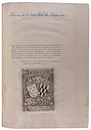
A±adir al carrito4to. (9 3/8 x 6 14/16 inches). Engraved portrait frontispiece, 4 folding engraved maps and 4 folding tables, number in ink manuscript to foot of title, epigraph leaf with later ink note and bookplate of Maria Zoila Godoy de Cobo [bound with:] Apķndice a la Relacion del Viage al Magallanes. Madrid: Viuda de Joaquin Ibarra, 1793. First Edition. Folding table and folding map. Contemporary red morocco gilt, with supralibros of Charles III on boards, double-fillet and roll-tooled borders to boards, raised bands to spine with simple tooling, green morocco lettering piece, blue silk endpapers. Provenance: Maria Zoila Godoy de Cobo, Argentinian heiress, philanthropist and patron of the arts, one of the early benefactors of the Museo Nacional de Bellas Artes of Buenos Aires, Argentina; engraved bookplate. First edition, one of the classic works of navigation to the Magellan Strait, here in a fine copy bound in the contemporary red morocco with the arms of Charles III of Spain, bound post mortem, as the appendix was printed in 1793 and Charles III died in 1793; normally only the Relacion is found bound with Charles III s arms, copies with both works bound together as here with the arms are excessively rare. It can be considered a tribute to Charles III, under whose reign the expedition was ordered. The fact that even after the King's death there was a desire to have the book presented with his arms is a testament to the magnitude of the expedition commissioned by the crown, and the respect held for the King, one of the most active in the administration and reform of the Indies. The Relacion is one of the best descriptions of the Strait of Magellan and Patagonia in the 18th century. It is based on the scientific explorations undertaken by Captain Antonio de Cordoba on board the frigate Santa Maria de la Cabeza, with the aim of exploring Patagonia and to determine the continuity of the use of the Strait for Spanish ships in voyages to the Pacific, although without success as "after these expeditions the Spanish trade routes were exclusively to east ports and then overland to the Pacific ports" (Hill). Vargas y Ponce, to whom authorship is normally attributed, used also the journals of Lieutenants Galiano and Belmonte, who sailed with Cordoba. In 1793, the Appendix (present here) was published "Obra interesante y bien publicada" (Palau); this later part is a historical view of former expeditions, including those of Drake and Bougainville. The illustration of this work comprises between the Relacion and the Appendix five large folding maps (including the "Carta reducida del Estrecho de Magallanes", "Carta Esferica de la parte sur de la Amķrica Meridional", and two multi-inset maps of ports), a frontispiece portrait of Fernando de Magallanes by Selma, and five folding tables. Sabin 16765 & 1729; Hill 1756; Howgego c180; JCB II, 3224; Palau 352514 & 352515.
-
Relaci¾n Del ┌ltimo Viage Al Estrecho De Magdallanes De La Fragata De S. M. Santa MarĒa De La Cabeza En Los A±os De 1785 Y 1786. [WITH:] .Apendice A La Relaci¾n Del Viage Al Magallanes De La Fragata De Guerra Santa MarĒa De La Cabeza, Que Contiene
Publicado por Por la Viuda de Ibarra, Hijos y CompanĒa, Madrid, 1783
Librería: The Book Collector, Inc. ABAA, ILAB, Fort Worth, TX, Estados Unidos de America
Miembro de asociaci¾n: ABAA ILAB IOBA TXBA
Calificaci¾n del vendedor: 5 de 5 estrellas

Original o primera edici¾n
EUR 2.940,19
Convertir monedaEUR 6,15 gastos de envĒo en Estados Unidos de AmericaCantidad disponible: 1 disponibles
A±adir al carritoHardcover. Condici¾n: Very Good. 1st Edition. 2 volumes. [3]+xvi-359 pages with engraved frontispiece portrait of Magellan by Ferdinand, 4 folding tables and 3 folding maps. Appendice: [ii]+97 pages with one folding table and one folding map Lacks the map Carta reducida del estrecho de Magallanes, fragata de S.M. Santa MarĒa de la Cabeza. Royal octavo (9 3/4" x 7 1/2") bound in full leather red and black labels to spine in gilt lettering. (Palau 352514 & 352515; Sabin 16765) First edition. The official Spanish documentation of the scientific voyage of the frigate St. Maria de la Cabeza to the Straits of Magellan, the gateway to the Pacific. The expedition served the purpose of gathering scientific and hydrographic information and typified the efforts Spain was making to stimulate research and exploration in her colonies. The second half of the relacion chronicles the historic voyages through the straits, from Magellan and Drake to Bougainville. The maps are fine examples of rare 18th-century Spanish cartography. Two of the charts are detailed delineations of the South American tip and the Tierra del Fuego region, while the other two depict ports along the Straits of Magellan. The appendix includes a description of the Peruvian people. After these expeditions, the Spanish trade routes were exclusively to east coast ports and then overland to Pacific ports. Josķ de Vargas Ponce was a midshipman and later appointed Second Lieutenant and was a member of the Real Academia de la Historia where he worked with Banza and the mathematician Vicente Tofino where he contributed in the publishing the Martime Atlas of Spain. In 1787 he published his description of the Pithiusas and Balearic Islands. Condition: Lacks one map. Appendix rubbed and scuffed. Corners bumped else a very nice set.
-

Relacion del ultimo viage al estrecho de Magallanes de la fragata de S. M. Santa MarĒa de la Cabeza en los a±os de 1785 y 1786.
Publicado por Madrid: Por la viuda de Ibarra, hijos y compa±Ēa, MDCCLXXXVIII. [1788]., 1788
Librería: Arader Galleries - AraderNYC, New York, NY, Estados Unidos de America
Calificaci¾n del vendedor: 5 de 5 estrellas
Original o primera edici¾n
EUR 4.071,03
Convertir monedaGratis gastos de envĒo en Estados Unidos de AmericaCantidad disponible: 1 disponibles
A±adir al carritoHalf-Leather. Condici¾n: Very Good. 1st Edition. Remainder of title: Extracto de todos los anteriores desde su descubrimiento impresos y mss. y noticia de los habitants, suelo, clima y producciones del estrecho. 2 volumes, 4to (25 x 18.5 cm.): vol. I: engraved frontispiece (portrait of Magellan by Fernando Selma), [6], xvi, 359 pages, 4 folded engraved maps, and 4 folded letterpress tables (i.e. pp. 71-74); vol. II (Apķndice de la Relacion): [4], 128 pages, 1 folded engraved map, and 1 foldied letterpress table (i.e. p. 98). Bound in varying but complementary contemporary calf-backed marbled paper boards, printed paper spine label on volume one, and red morocco lettering-piece on the spine of the appendix volume (a bit worn at the extremities with minor loss). FIRST EDITION OF THE FIRST COMPREHENSIVE SURVEY OF THE STRAITS OF MAGELLAN AND PATAGONIA. The work was largely compiled from the journals of D.A. Galiano and A. Belmote, Antonio de Cordova's lieutenants, on the his two important expeditions sponsored by the Spanish government in order to determine the feasibility of continuing to use the Straits of Magellan as a route to the Pacific. In addition, the work contains a comprehensive history of the discovery of the strait and includes accounts of the expeditions of Cabot, Drake, Bougainville, Carmargo etc.; the appendix includes a description of the Peruvian people. "After these expeditions, the Spanish trade routes were exclusively to east coast ports and then overland to Pacific ports" (Hill 1756). The five important maps include: "Carta Esferica de la Parte sur de la America Meridional., 1788"; "Carta reducida del Estrecho de Magallanes, 1788"; "Primer Plano de Varios Puertos del Estrecho de Magallanes, Levantados el ano de 1786," with insets of the ports of Bahia De San Nicolas, Tres Bahias, Bahia De Valcarcel, Puerto De San Miguel y Bahia De Gaston, and Puerto De San Antonio y Bahia Valdes; "Segundo Plano de Varios Puertos del Estrecho de Magallanes Levantados el ano de 1786"; and in the appendix, "Carta Reducida del Estrecho de Magallanes, 1786-1789." REFERENCES: Hill (2004) 1756; Palau 352514 & 352515; Sabin 16765 (not including the appendix). Book.
-
![Imagen del vendedor de Relaci¾n Del ┌ltimo Viage Al Estrecho De Magdallanes De La Fragata De S. M. Santa MarĒa De La Cabeza En Los A±os De 1785 Y 1786. [WITH:] .Apendice A La Relaci¾n Del Viage Al Magallanes De La Fragata De Guerra Santa MarĒa De La Cabeza, Que Contiene El De Los Paquebotes Santa Casilda Y Santa Eulalia Para Completar El Reconocimiento Del Estrecho En Los A±os De 1788 Y 1789. a la venta por D & E LAKE LTD. (ABAC/ILAB)](https://pictures.abebooks.com/inventory/md/md1427758893.jpg)
Relaci¾n Del ┌ltimo Viage Al Estrecho De Magdallanes De La Fragata De S. M. Santa MarĒa De La Cabeza En Los A±os De 1785 Y 1786. [WITH:] .Apendice A La Relaci¾n Del Viage Al Magallanes De La Fragata De Guerra Santa MarĒa De La Cabeza, Que Contiene El De Los Paquebotes Santa Casilda Y Santa Eulalia Para Completar El Reconocimiento Del Estrecho En Los A±os De 1788 Y 1789.
Publicado por Madrid: Por la Viuda de Ibarra, Hijos y CompanĒa, 1788-93., 1788
Librería: D & E LAKE LTD. (ABAC/ILAB), Toronto, ON, Canada
Miembro de asociaci¾n: ABAC ILAB
Calificaci¾n del vendedor: 2 de 5 estrellas

Original o primera edici¾n
EUR 4.071,03
Convertir monedaEUR 13,17 gastos de envĒo desde Canada a Estados Unidos de AmericaCantidad disponible: 1 disponibles
A±adir al carritoHardcover. Condici¾n: Very Good. 1st Edition. 2 Volumes in 1. 4to. pp. 3 p.l., xvi, 70, 75-359; 2 p.l., 128. 4 folding tables numbered 71-74 inserted between pp. 70 and 75 in Vol. I. 1 folding table in Vol II. engraved portrait of Magellan by Ferdinand Selma. 5 large folding engraved maps, 2 with 12 plans of ports, another with 3 inset plans. 19th century quarter roan (spine incorrectly lettered, occasional light spotting, last map stained, few short insignificant tears in maps). First Edition, complete with the Rare Supplement. An account of Don Antonio de C¾rdoba's scientific and hydrographic survey of the Strait of Magellan, 1785-86, 1788-89, compiled by Josķ de Vargas Y Ponce, Spanish geographer and naval officer, mainly from the journals of C¾rdoba's lieutenants, Dionisio Alcalß Galiano and Alejandro Belmonte. The expedition was appointed by the Spanish Crown to determine the exact navigability of the strait and the advisability of the Spaniards continuing to use the passage in voyages to the Pacific, as well as to investigate the plant and animal life of the region, with a view toward colonization. The findings were negative and the Spaniards subsequently exclusively favoured overland trade routes from east coast ports of South America to the Pacific ports. Included in the first volume are extensive notes on the natural history and climate of the region, an account of the customs of the Patagonian Indians, and a resumķ of discovery and exploration from the time of the discovery of the strait by Magellan through the voyages of Sarmiento de Gamboa, Drake, Spilberg, Narborough, Carteret, Bougainville, &c. Bell V25 (without the supplement). Hill p. 305. Howgego C180. JCB II 3224. Sabin 16765 (without the supplement & incorrectly attributing the work to C¾rdoba).
-
RELACION DEL ┌LTIMO VIAGE AL ESTRECHO DE MAGALLANES DE LA FRAGATA DE S.M. SANTA MARIA DE LA CABEZA EN LOS ANOS DE 1785 Y 1786. EXTRACTO DE TODOS LOS ANTERIORES DESDE SU DESCUBRIMIENTO IMPRESOS Y MSS. Y NOTICIA DE LOS HABITANTES, SUELO, CLIMA, Y PRODUCCIONES DEL ESTRECHO.
Publicado por Madrid: La viuda de Ibarra, hijos, y compa±ia, 1788., 1788
Librería: William Reese Company - Americana, New Haven, CT, Estados Unidos de America
Miembro de asociaci¾n: ABAA ESA ILAB SNEAB
Calificaci¾n del vendedor: 4 de 5 estrellas
EUR 4.071,03
Convertir monedaEUR 12,30 gastos de envĒo en Estados Unidos de AmericaCantidad disponible: 1 disponibles
A±adir al carrito[6],xvi,359pp. including four folding tables and four large folding maps. Frontispiece portrait of Magellan by Ferdinand Selma. [bound with:] APENDICE A LA RELACION DEL VIAGE AL MAGALLANES. Madrid. 1793. [4],128pp. including folding table and folding map. Quarto. 19th-century half calf and patterned cloth, spine gilt, original gilt leather label on front board. Moderate edge wear, corners worn. Modern bookplate and small bookseller ticket on front pastedown. Titlepage a bit dusty, else internally clean. Very good. The objective of the voyages recorded here was to determine whether Spanish ships should continue to use the Straits of Magellan in voyages to the Pacific. Under the command of Captain Antonio de C¾rdoba y Laso, both expeditions ascertained negative conclusions, and afterwards "the Spanish trade routes were exclusively to east coast ports and then overland to Pacific ports" (Hill). A major portion of this work, the first comprehensive study of the Straits of Magellan and Patagonia, was compiled from the journals of D.A. Galiano and A. Belmote, Cordoba's lieutenants. The Relacion. also includes Vargas y Ponce's review of earlier explorations of the area, with descriptions of the region's climate, natural resources, and native peoples. Also includes information on the expeditions of Cabot, Drake, Bougainville, Carmargo, and others. HILL 1756. SABIN 16765, 1729. PALAU 352514, 352515.
-
RELACION DEL ┌LTIMO VIAGE AL ESTRECHO DE MAGALLANES DE LA FRAGATA DE S. M. SANTA MAR═A DE LA CABEZA EN LOS AčOS DE 1785 Y 1786. Extracto de todos los anteriores desde su descubrimiento impresos y MSS. y noticia de los habitantes, suelo, clima y producciones del estrecho.
Publicado por Imp. Viuda de Ibarra. Madrid, 1788, 1788
Librería: FARR╔ Libreria Anticuaria, Barcelona, BARCE, Espa±a
Miembro de asociaci¾n: AILA ILAB
Calificaci¾n del vendedor: 4 de 5 estrellas
EUR 3.610,00
Convertir monedaEUR 20,00 gastos de envĒo desde Espa±a a Estados Unidos de AmericaCantidad disponible: 1 disponibles
A±adir al carrito. 23,5 cm. 3 h., XVI-359 pßg. 1 lßmina de grabado con retrato de Magallanes, firmado por Fernando Selma en 1788, 4 lßminas plegadas de grabados con mapas del estrecho de Magallanes y sus puertos y del sur de la Amķrica meridional, 4 lßminas plegadas -paginadas 71-74- con tablas de navegaci¾n. [Sigue:] AP╔NDICE A LA RELACION DEL VIAGE AL MAGALLANES DE LA FRAGATA DE GUERRA SANTA MAR═A DE LA CABEZA, que contiene el de los paquebotes Santa Casilda y Santa Eulalia para completar el reconocimiento del estrecho en los a±os de 1788 y 1789. Imp. de la viuda de JoaquĒn Ibarra. Madrid, 1793. 2 h., 128 pßg. 1 lßmina plegada con mapa del estrecho de Magallanes, 1 lßmina plegada -paginada 98- con tabla de navegaci¾n. Enc. en media piel, puntas algo rozadas. * Josķ de Vargas y Ponce (Cßdiz, 1760 - Madrid, 1821) es el encargado de recoger y ordenar los materiales que le facilitaron Dionisio Alcalß Galiano y Alessandro Belmonti, miembros de la expedici¾n, y lo enriqueci¾ con los datos aportados anteriormente por Sarmiento de Gamboa, Drake, Spilberg, Narborough, Carteret, Bougainville. La expedici¾n fue promovida por la Corona espa±ola con la intenci¾n de determinar la viabilidad de la ruta por el PacĒfico, por un lado, y por el otro considerar las condiciones para asentar nuevas colonias espa±olas. AsĒ pues, comprende numerosas noticias interesantes sobre el clima, geografĒa, naturaleza y sociedad en Patagonia, Tierra de Fuego, Chile. Los mapas se deben al piloto JoaquĒn Camacho. Palau 352514-5.
-
Relacion del ·ltimo Viage al Estrecho de Magallanes de la Fragata de S.M. Santa Maria de la Cabeza en los an(n)os de 1785 y 1786. Extracto de todos los anteriores desde su descubrimiento impresos y MSS. Y Noticia de los Habitantes, Suelo, Clima y Prod.
Librería: Herman H. J. Lynge & S°n ILAB-ABF, Copenhagen, Dinamarca
Miembro de asociaci¾n: ABF ILAB
Calificaci¾n del vendedor: 4 de 5 estrellas
Original o primera edici¾n
EUR 3.444,60
Convertir monedaGratis gastos de envĒo desde Dinamarca a Estados Unidos de AmericaCantidad disponible: 1 disponibles
A±adir al carritoMadrid, 1788-93. 4to. Bound in 2 nice contemp. full sprinkled calf. Gilt borders on covers, 5 raised bands, gilt spine, titlelabels with gilt lettering. The Appendice slightly different bound, but matching. Fine marbled endpapers. Engraved portrait. (6),XVI,359 pp. and 4 folded tables, 4 large folded engraved maps. Appendix: (4),128 pp., 1 folded table and 1 folded engraved map. Clean and fine printed on thick paper. A small wormtract in top of the last 2 maps and the last few leaves (margins). First edition of two important expeditions by Antonio de C¾rdoba. The first voyage was made with the intention of surveying the Straits of Magellan to see if it was advisable for the Spaniards to continue to use it as a route to the Pacific. It also includes a history of the discovery of the strait, as well as of the expeditions of Cabot, Drake, Bougainville, Carmargo and others. The second voyage includes an interesting account by Cevallos of the first encounter with the natives.Sabin, 16765.
-
Relacion del Ultimo Viage al Estrecho de Magallanes de la Fragata de S.M. Santa Maria de La Cabeza en los Anos de 1785 y 1786: Extracto de Todos los Anteriores desde su descubrimiento impresos y MSS.
Publicado por 1788-1793, 1788
Librería: Maggs Bros. Ltd ABA, ILAB, PBFA, London, Reino Unido
Miembro de asociaci¾n: ABA ILAB PBFA
Calificaci¾n del vendedor: 5 de 5 estrellas
EUR 6.019,43
Convertir monedaEUR 31,56 gastos de envĒo desde Reino Unido a Estados Unidos de AmericaCantidad disponible: 1 disponibles
A±adir al carrito -
Relaci¾n del ·ltimo viage al Estrecho de Magallanes de la fragata de S.M. Santa MarĒa de la Cabeza en los a±os de 1785 y 1786 [and] Apķndice a la Relacion
Publicado por Ibarra, Madrid, 1793
Librería: Hordern House Rare Books, Potts Point, NSW, Australia
Miembro de asociaci¾n: ANZAAB ILAB
Calificaci¾n del vendedor: 5 de 5 estrellas
Original o primera edici¾n
EUR 4.548,84
Convertir monedaEUR 13,35 gastos de envĒo desde Australia a Estados Unidos de AmericaCantidad disponible: 1 disponibles
A±adir al carritoCondici¾n: A very good copy. Quarto, two volumes bound together, with an engraved portrait of Magellan as frontispiece, five fine large folding maps and five folding tables; contemporary calf-backed marbled boards.f. The full first edition, complete with the separately published Apendice a la Relaci¾n (Madrid, 1793) which appeared ten years after the main work and is not present in all copies. This is the best early description of Patagonia and the Straits of Magellan, giving the official account of the two expeditions made by Antonio de C¾rdoba to 'ascertain the advisability of Spaniards continuing to use the Strait in voyages - the results indicated the negative. After these expeditions the Spanish trade routes were exclusively to east coast ports and then overland to the Pacific ports' (Hill). As part of this, the Relaci¾n provides a general history of earlier voyages of discovery to the Strait. The large folding maps, fine and detailed, are all based on observations made during the C¾rdoba voyages. C¾rdoba's exploration of the Strait of Magellan --recognised then as now an area of strategic and navigational significance -- is accompanied by Vargas y Ponce's summary of the early explorations of the area, mainly from an examination of original manuscripts in the Spanish archives. He discusses various means of navigating the Strait, with detailed sailing instructions, and describes the climate, indigenous peoples and natural history of the region. .
-

RELACION DEL ULTIMO VIAGE AL ESTRECHO DE MAGALLANES DE LA FRAGATA DE S.M. SANTA MAR═A DE LA CABEZA EN LOS AčOS 1785 Y 1786. EXTRACTO DE TODOS LOS ANTERIORES DESDE SU DESCUBRIMIENTO IMPRESOS Y MSS. Y NOTICIA DE LOS HABITANTES, SUELO, CLIMA Y PRODUCCIONES.
Publicado por VIUDA DE IBARRA, HIJOS Y COMPAč═A, MADRID, 1788
Librería: LIBRERIA TORMOS, Aldeamayor Golf, VALLA, Espa±a
Calificaci¾n del vendedor: 5 de 5 estrellas
EUR 2.975,00
Convertir monedaEUR 10,00 gastos de envĒo desde Espa±a a Estados Unidos de AmericaCantidad disponible: 1 disponibles
A±adir al carritoENCUADERNADO EL LOMO EN PIEL DE CABRA, CONTIENE ESTUCHE DECORATIVO DEL MISMO COLOR QUE LAS TAPAS. RETRATO DE FERNANDO DE MAGALLANES EN FRONTISPICIO + XVI + 359 P┴GINAS + 4 TABLAS DESPLEGABLES, 4 MAPAS DESPLEGABLES. NO CONTIENE AP╔NDICE. ESTE LIBRO TRATA SOBRE EL VIAJE DE EXPLORACIėN M┴S IMPORTANTE DEL SIGLO XVIII AL ESTRECHO DE MAGALLANES. CONTIENE MAPAS MUY DETALLADOS DE LA PATAGONIA, TIERRA DEL FUEGO, LAS ISLAS MALVINAS Y EL ESTRECHO. ATRIBU═DO A JOS╔ VARGAS PONCE (1760-1821), EL TRABAJO ES EN GRAN PARTE COMPILADO POR DOS LUGARTENIENTES DEL VIAJE, DIONISIO ALCAL┴ GALIANO (1760-1805) Y ALESSANDRO BELMONTI. LOS PRINCIPALES OBJETIVOS DE LA EXPEDICIėN, BAJO EL MANDO DEL CAPIT┴N ANTONIO DE CėRDOBA (MUERTO EN 1811), FUE DETERMINAR SI EL ESTRECHO ERA UNA RUTA COMERCIAL VIABLE PARA ASIA Y EL PAC═FICO, EL MAPA DE LAS COSTAS PATAGėNICAS, Y RECOMENDAR LOS SITIOS DE ASENTAMIENTO ESPAčOL. LOS OFICIALES Y LA TRIPULACIėN DE LA FRAGATA DE GUERRA SANTA MAR═A DE LA CABEZA, ESTUDIANDO LA REGIėN, LA POBLACIėN NATIVA, LAS CONDICIONES DEL SUELO, EL CLIMA, LA FLORA, Y LA FAUNA; HICIERON MAPAS DE LA ZONA, Y SE OBSERVA M┴S CUIDADOSA EN LOS PUERTOS, LAS CORRIENTES, AS═ COMO OTROS DATOS NECESARIOS PARA MARINEROS QUE ATRAVIESEN LA EXTENSIėN DEL TRAICIONERO ESTRECHO. AL FINAL, SIN EMBARGO LLEGARON A LA CONCLUSIėN DE QUE EL ESTRECHO ERA DEMASIADO PELIGROSO, LO QUE HACE EL TRANSPORTE TERRESTRE PREFERIBLE ENTRE ATL┴NTICO Y PAC═FICO. LOS INFORMES DEL VIAJE, SON LA INFORMACIėN M┴S PRECISA DE LA ZONA SUR DE ARGENTINA Y CHILE ENTONCES DISPONIBLE. EL LIBRO DESMIENTE QUE LOS PATAGONES SEAN GIGANTES, COMO ANTIGUAMENTE SE PENSABA POR ┌LTIMO ESTE LIBRO CONTIENE NUMEROSOS CAP═TULOS DE ANTERIORES VIAJES A TRAV╔S DEL ESTRECHO POR OTROS NAVEGANTES. EL PAPEL DEL LIBRO ES DE UNA EXTRAORDINARIA CALIDAD, ESTE LIBRO HA SIDO ADEM┴S RESTAURADO Y TRATADO PARA EVITAR SU DETERIORO, ES POR ELLO, QUE SE TRATA DE UN EXCELENTE EJEMPLAR, PERFECTAMENTE CONSERVADO. Size: 25 X 20.

![Imagen del vendedor de Relaci¾n Del ┌ltimo Viage Al Estrecho De Magdallanes De La Fragata De S. M. Santa MarĒa De La Cabeza En Los A±os De 1785 Y 1786. [WITH:] .Apendice A La Relaci¾n Del Viage Al Magallanes De La Fragata De Guerra Santa MarĒa De La Cabeza, Que Contiene a la venta por The Book Collector, Inc. ABAA, ILAB](https://pictures.abebooks.com/inventory/md/md31130195054.jpg)


![Imagen del vendedor de Relaci¾n del ·ltimo viage al Estrecho de Magallanes de la fragata de S.M. Santa MarĒa de la Cabeza en los a±os de 1785 y 1786 [and] Apķndice a la Relacion a la venta por Hordern House Rare Books](https://pictures.abebooks.com/inventory/md/md13245438754.jpg)